Mediterranean Sea Central & West (Platinum) | 4Boats
010-C1317-40
- Dispatched in 2-3 days
- 30 Day Return Policy
- In stock, ready to ship
- Backordered, shipping soon
No reviews
Our stock levels are dynamic and can change frequently. If a product appears to be in stock, it may have already sold out. Please contact us if you have any questions about availability. Thank you for your understanding.
Regular price£260.00
/
Tax included.
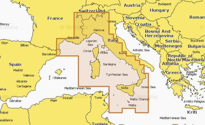
Mediterranean Sea Central & West (Platinum) charts — premium nautical mapping for coastal and inland navigation with daily updates and advanced SonarChart features.
- justify-content: flex-start; display: flex; flex-direction: column; background-position: left top; background-size: cover; background-repeat: no-repeat; background-attachment: scroll
- Table style width: 522px; column widths: 378.49px and 129.549px
- Coastal coverage plus 42,000+ inland lakes
- Detailed nautical charts with daily updates
- Dock-to-dock route guidance and Plotter Sync
- SonarChart™ Live mapping; relief shading via Chart Installer
- Satellite imagery with SonarChart shading overlay and aerial photography
Compatible with plotters supporting Platinum+ charts; includes community edits and advanced map options for precise route planning.
For the products under £150 the shipping is £6.99.
Free delivery for most items over £150.