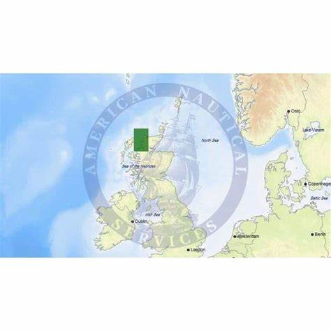
C-Map Scotland North: West Coast - MAX | Electronic Chart | 4Boats
NVM-EW-M044-MS
- Dispatched in 2-3 days
- 30 Day Return Policy
- Low stock - 1 item left
- Backordered, shipping soon
No reviews
Our stock levels are dynamic and can change frequently. If a product appears to be in stock, it may have already sold out. Please contact us if you have any questions about availability. Thank you for your understanding.
Regular price£173.41
/
Tax included.
Reliable MAX vector chart covering Scotland's north and west coasts for detailed coastal and offshore navigation.
- C-Map EW-M044 - Scotland North: West Coast - MAX - European - Local
- MAX vector format with high-resolution bathymetry and depth contours in metres (ft)
- Detailed harbour plans, approaches and island inlets
- Waypoints, routes and navigational aids for coastal passages
- Compatible with MAX-enabled chartplotters and major chartplotter brands
- Local European dataset with regular chart updates via C-Map services
- Delivered as device-ready chart file for straightforward installation
For the products under £150 the shipping is £6.99.
Free delivery for most items over £150.