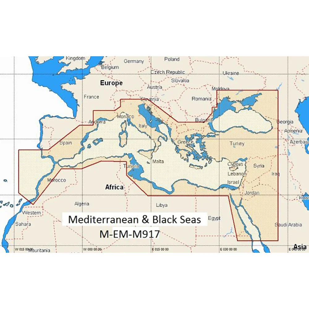
C-Map Mediterranean & Black Sea MAX EN | M917 | 4Boats
NVM-EM-M917-MS
- Dispatched in 2-3 days
- 30 Day Return Policy
- Low stock - 2 items left
- Backordered, shipping soon
No reviews
Our stock levels are dynamic and can change frequently. If a product appears to be in stock, it may have already sold out. Please contact us if you have any questions about availability. Thank you for your understanding.
Regular price£306.80
/
Tax included.
C-Map Mediterranean & Black Sea Max EN chart pack for accurate coastal navigation across the Mediterranean & Black Sea.
- Coverage: Complete Mediterranean & Black Sea charts
- Format: C-Map MAX EN (M917)
- Language: English (EN)
- Compatibility: Works with C-Map MAX chartplotters and compatible MFDs
- Bathymetry: High-resolution bathymetry and depth contours
- Harbour plans: Detailed ports, berths and marina data
- Navigational aids: Buoyage, lights and route-planning support
For the products under £150 the shipping is £6.99.
Free delivery for the most items over £150.